Collection of Ordnance Survey Maps and Other Items
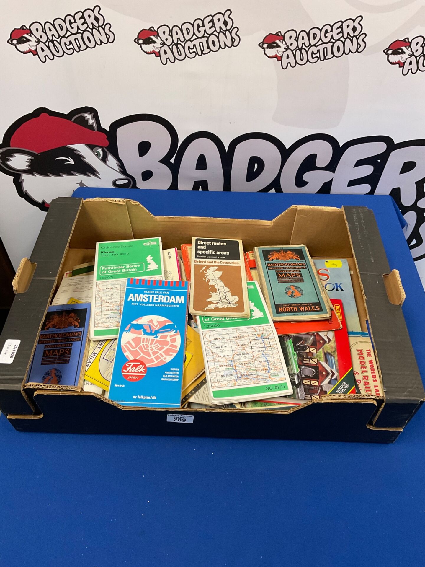
This lot comprises a mixed collection of maps and related printed ephemera, offered loose in a cardboard box. Visible material includes an Ordnance Survey Pathfinder Series sheet for Kinross (sheet NO 00/10, scale 1:25,000), a Bartholomew’s Revised Half-Inch Contoured map of Great Britain, Sheet 37, North Wales, and a Bartholomew’s Revised Half-Inch Contoured Maps folder in blue. Also present are a Direct Routes and Specific Areas map of Oxford and the Cotswolds, a Kleine Falk van Amsterdam street plan with a Falkplan cover, and further Ordnance Survey sheets of Great Britain at 1:25,000. A small number of publications, including a model railway title, are also included.
Age, Handling and Collector Interest
The maps and booklets show the wear expected of items that have been folded and stored over time, and they have not been individually assessed for condition. Items within the box vary in size and publisher, and some are only partly visible, so bidders are encouraged to view the lot in person or request further details before bidding. The mix of Ordnance Survey sheets, Bartholomew’s contoured maps and European city plans may appeal to collectors of cartography, to those interested in mid-twentieth-century British and continental travel, and to anyone seeking material for reference or display.