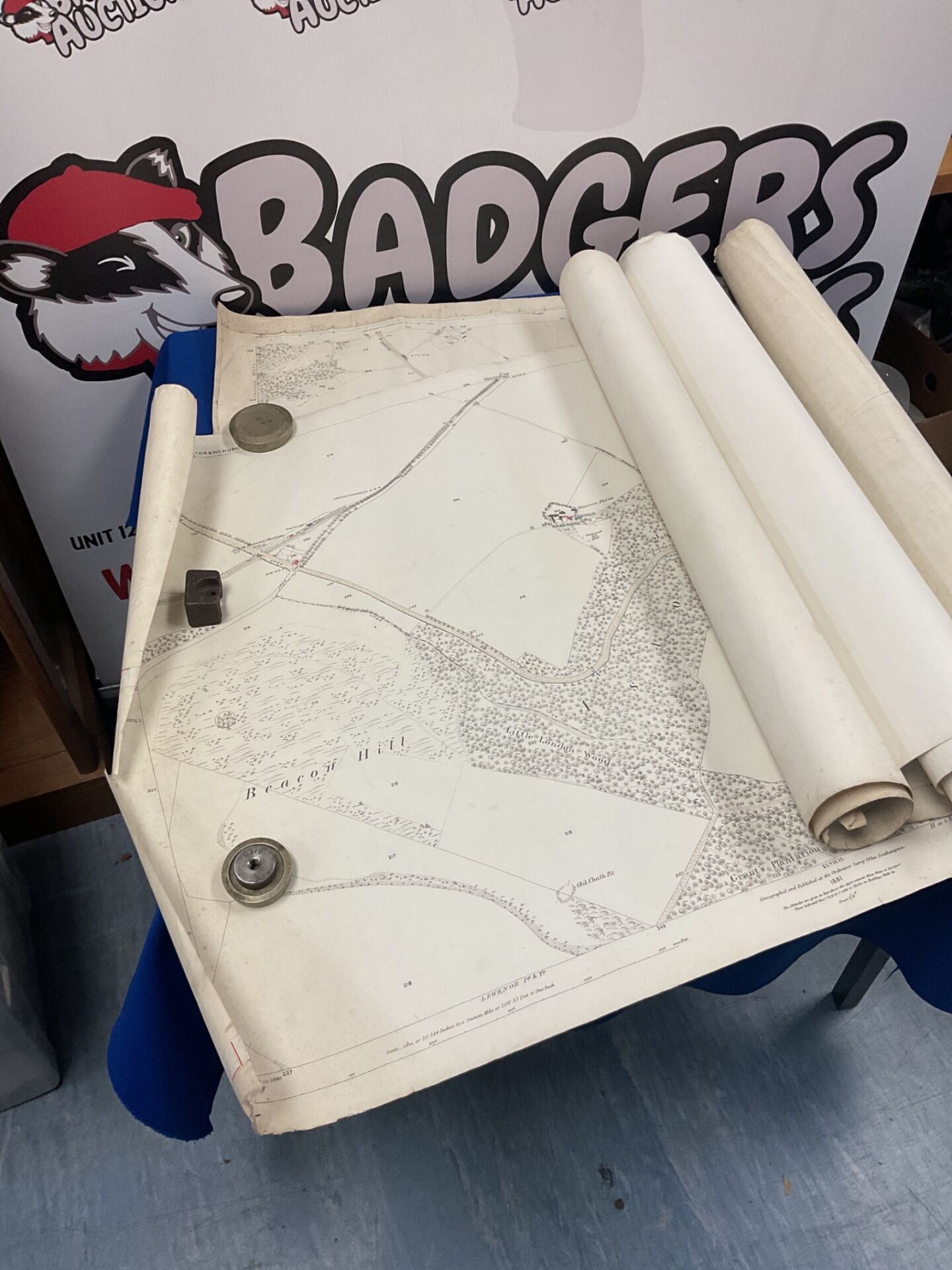
Selection of Vintage Ordnance Survey Maps of Stokenchurch, Aston Rowant and Surrounding Areas
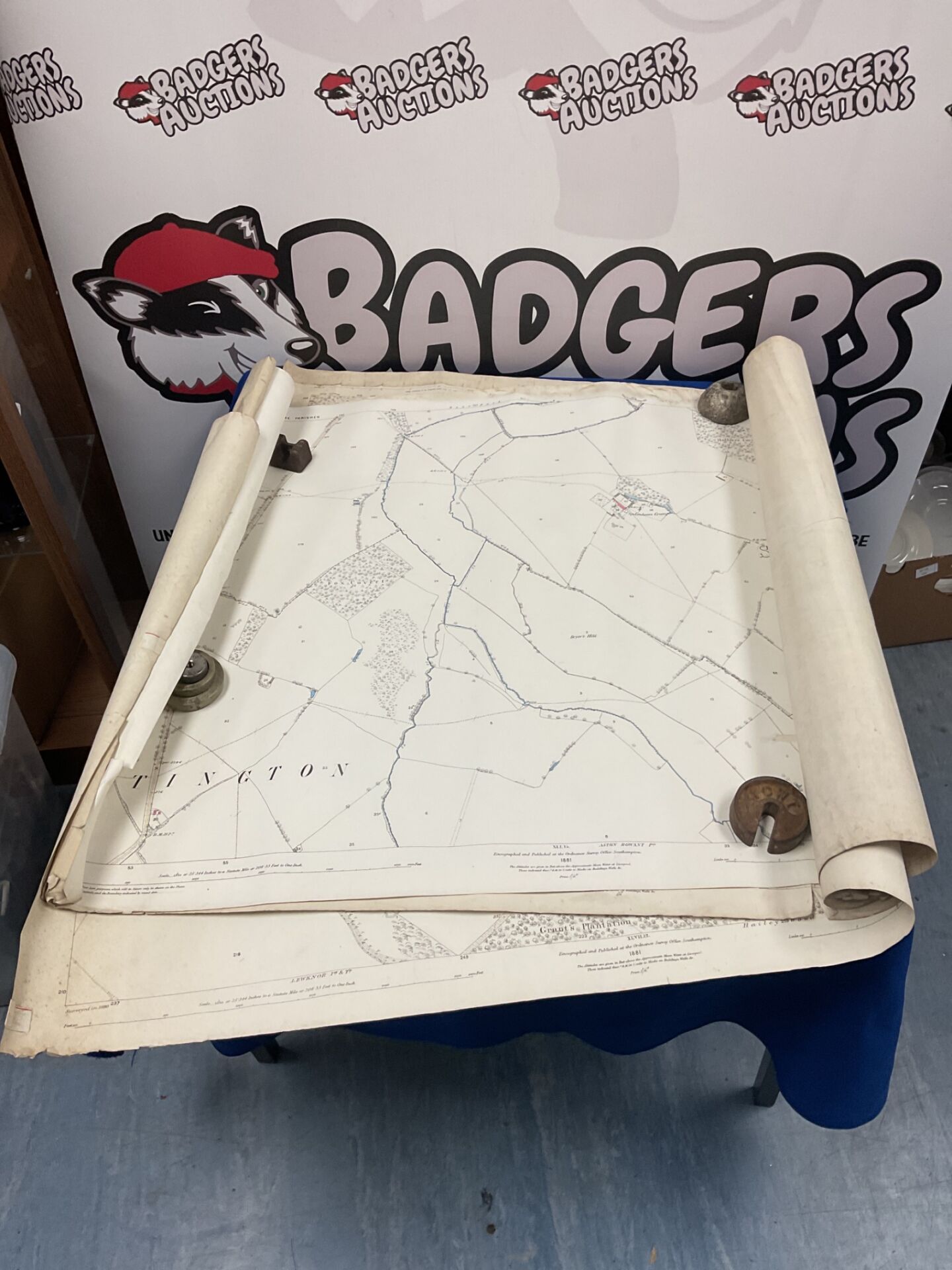
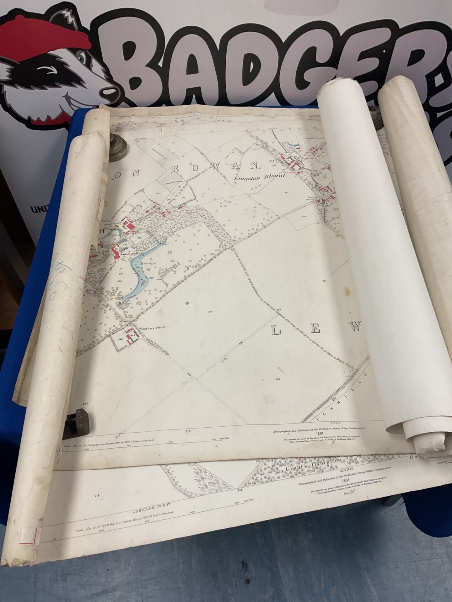
This lot comprises a selection of vintage Ordnance Survey map sheets covering Stokenchurch, Aston Rowant and other local areas. The sheets are printed on paper and are offered as a group. Printed legends on the sheets give the date as 1881 and credit the Ordnance Survey Office, Southampton, as the publisher. The printed scale is 25.344 inches to a statute mile, or 208.33 feet to one inch. Sheet references visible on the paper include XLVII.8, XLVII.12 and XLVIII.9. The maps show field boundaries, woodland, watercourses, roads and named features including Kingston Blount, Aston Rowant, Lewknor, Beacon Hill and Little London Wood. Hand-coloured red and blue detailing is visible in places, and the sheets are of the traditional large-format style produced for the period.
Condition and Collectable Interest
The sheets are presented rolled and show age-related handling marks, creasing and edge wear, including a small tear to one lower corner. The paper has a warm, aged tone consistent with its date. Printed detail remains legible across the sheets. Items of this kind are often sought by collectors of local history, historic cartography and Victorian topographical material, as well as by researchers and those with a connection to the villages named. Buyers should note that this is a group of sheets offered as found, and condition should be considered when bidding.